The Ice Age and Origins of the Humber Watershed
Toronto, Ontario
Overview of Geological Origins of the Humber River
Part II
The geological history of the Humber River is complicated and involves a journey that starts in the distant past of Geological time.
During this extended period of time, plate tectonics, continental drift, volcanic activity, oceanic and inland sea deposition, orogenic mountain building
as well as continental glaciation created the North American continent as we know it to-day.
| Click for formal Geological Time Scale |

Physical Events
The concept of plate tectonics and continental drift is central to understanding the evolution of the continents as they presently are located on the globe to-day. Few people appreciate the forces that shaped the earth and the oceans, as well as the time span that this took place over.
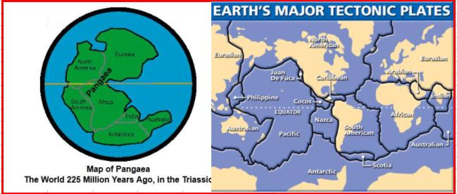
That this entity ancient continent "Pangeae" became the world of to-day is one of the miracles that define the mystery of geology. However, it is the very forces that formed Pangeae
then rent it asunder, that were instrumental in shaping the geological origins of the Humber River watershed.