The Geologic Origins of the Humber Watershed
Toronto, Ontario
Overview of Geological Origins of the Humber River
Part I
Like river systems elsewhere in North America that are subject to the physical forces of nature including erosion,the Humber River of Southern Ontario is no exception.
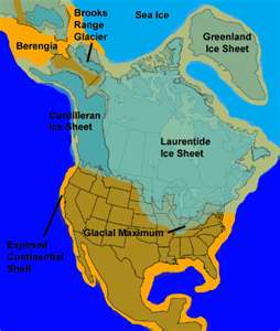
In addition, the origin of most river systems owes homage to historical geological events including plate tectonics, oceanic depositional events, surface water erosion and glaciation.
Stratigraphic Framework
The geology of the Humber watershed generally consists of Quaternary sediments infilling a fluvial valley system incised into the bedrock surface.
This bedrock valley system drained the upper Great Lakes basin to what is now the St. Lawrence River. This sedimentary package ranges in thickness from zero (bedrock outcrop) to 270 metres within the Laurentian bedrock valley system.
There are four main geologic features present, including:
* A bedrock valley system carved through the Georgian Bay Formation, that contains thick sand and gravel deposits
* The Niagara Escarpment that forms the western boundary of the Humber River watershed
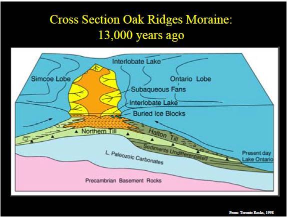
* The Oak Ridges Moraine (ORM) that forms the headwater of the watershed; and
* Areas where Quaternary sediments have eroded and largely in-filled with fining upwards sequences of sand and silt. This erosive action is attributed to tunnel channel formation beneath glacial ice (Sharpe et al, 2004).