The Ice Age and Origins of the Humber Watershed
Toronto, Ontario
Toronto, Ontario
Introduction
Overview of the
Humber River
Global and Continental Glaciation
Land Form development in North America
Geological History
of the Great Lakes
Development of the
Oak Ridges Moraine
Geology of the
Humber River Watershed
Ecology
Early Inhabitants
Photo Gallery - Humber River Watershed
Overview of the
Humber River
Global and Continental Glaciation
Land Form development in North America
Geological History
of the Great Lakes
Development of the
Oak Ridges Moraine
Geology of the
Humber River Watershed
Ecology
Early Inhabitants
Photo Gallery - Humber River Watershed
A Map of The Oak Ridges Terminal Moraine - Origins
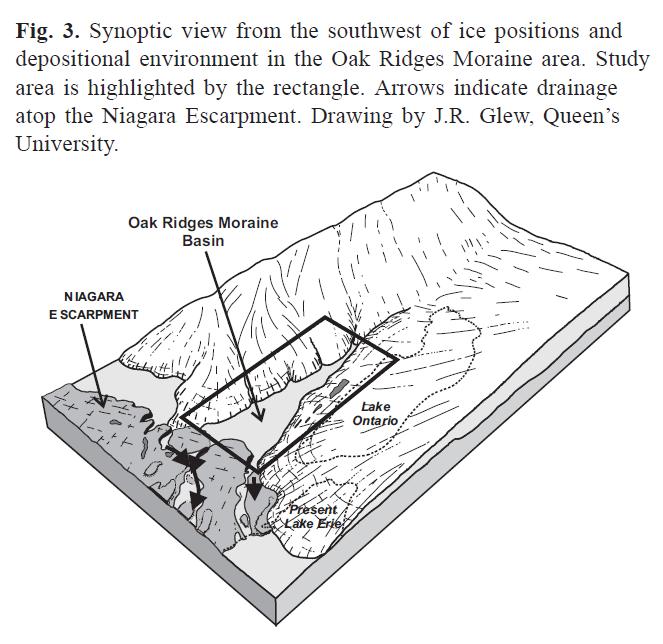
Part II Genesis of the Oak Ridges Moraine
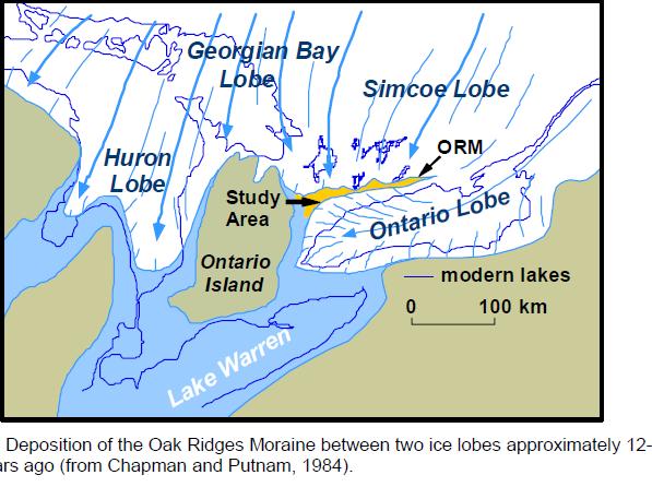
The Oak Ridges Moraine is a pair of large ridges composed of four elevated wedges. It is bounded to the west by the Niagara Escarpment, a cuesta which was critical
to the formation of the moraine, and to the east by the Trent River and Rice Lake. The four wedges (Albion, Uxbridge, Pontypool and Rice Lake from west to east)
formed in stages. The moraine peaks at the Uxbridge wedge, generally rising from east to west, a result of the moraine's west-to-east formation. That is, the western portion of the moraine received earlier and more frequent sedimentary deposition than the eastern portion, as the ice lobes which controlled the moraine's eastern formation slowly retreated. The Rice Lake wedge is separated from the other wedges where the Oak Ridges Moraine intersects Rice Lake.
To the north are drumlinized uplands, referred to as the Peterborough drumlin field.
Proceed to Part III => Geography of Oak Ridges Moraine
Proceed to Part III => Geography of Oak Ridges Moraine