N.A. Ice Map
The Ice Age and Origins of the Humber Watershed
Toronto, Ontario

Introduction

Overview of the
Humber River


Global and Continental Glaciation

Land form development in North America

Geological History
of the Great Lakes


Development of the
Oak Ridges Moraine


Geology of the
Humber River Watershed


Ecology

Early Inhabitants

Maps of the
Humber River Watershed

Photo Gallery - Humber River Watershed

click map image to enlargeThe Oak Ridges Terminal Moraine Map

A Map of The Oak Ridges Terminal Moraine

Part I -

A moraine is a glacially formed accumulation of unconsolidated glacial debris which can occur in currently glaciated and formerly glaciated regions, such as those areas acted upon by a past glacial maximum. This debris may have been plucked off a valley floor as a glacier advanced or it may have fallen off the valley walls as a result of frost wedging or landslide.

Moraines may be composed of debris ranging in size from silt-sized glacial flour to large boulders. The debris is typically sub-angular to rounded in shape.

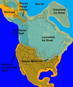
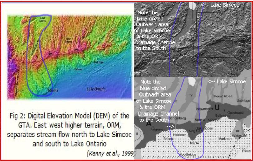
The Oak Ridges Moraine is the best example of a Terminal Moraine in S. Ontario with huge benefits to the inhabitants.

Click for => Home Page


| about us | contact us | links | privacy | credits | home |

See the Web Site re: The Falling Water Levels in the Great Lakes

[ Falling Waters Web Site ]