<
The Geologic Origins of the Humber Watershed
Toronto, Ontario
Overview of Geological Origins of the Humber River
Part IV - Paleozoic Bedrock
The Paleozoic bedrock units were deposited on the Canadian Shield over a period of 200 million years, beginning approximately 550 million years BP.
This includes the Simcoe and Georgian Bay sedimentary formations of Ordivician age, the latter forming the main
bedrock horizon of the Humber River and the GTA area.
A complex sequence of mountain-building events, driven by plate tectonics, occurred over this time. Sediments from the erosion of these mountains in filled the Michigan Basin
(a large circular-shaped basin centred on the State of Michigan) and were subsequently lithified.
These limestone and shale units make up the sedimentary bedrock units that underlie the Oak Ridges Moraine study area.
In addition, these limestone and shale bedrock units of Paleozoic age underlie the entire GTA area (as mapped by Johnson et al.,1992)
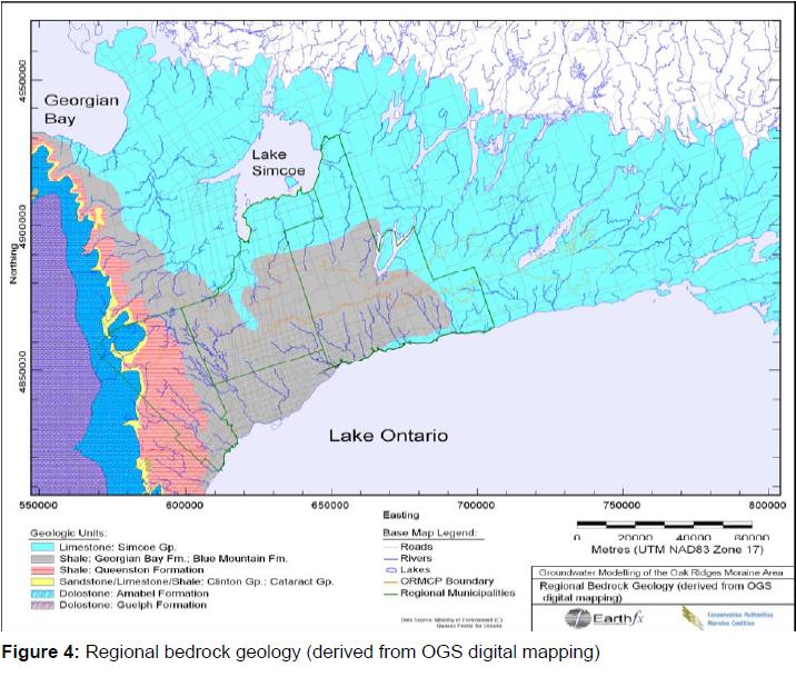
A coloured map based on the 1:1,000,000 scale OGS mapping is presented in Figure 4.
Note the Georgian Bay Formation in the GTA marked in purple/grey